
The Hiker's hip pocket Guide
to the Mendocino Highlands
by Bob Lorentzen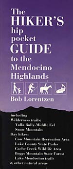
Includes trails in the Yolla Bolly-Middle Eel Wilderness and the Snow Mountain Wilderness
This classic covers over 325 miles of trails in 50 inland hikes exploring diverse terrain in six counties. Hikes near Ukiah and Lakeport include Clear Lake State Parks, Cow Mountain Recreation Area, Cache Creek Wildlife Area, Boggs Mountain State Forest, two Nature Conservancy preserves and other natural areas. Longer hikes cover all of Yolla Bolly-Middle Eel and Snow Mountain wilderness areas, with 30 elevation graphs and decriptions of 10 peak climbs. Lots of solitude!
We recently sold out of this title, our favorite Hiker's hip pocket Guide. We are now working on a second edition. Since this book covers more miles of trails than most of our guides, and since many of the trails are extremely remote, we can't yet say when it will be done. But we are working on it. We'll keep you posted. We hope to have the new edition ready by May 2008.
If you'd like to be on our list to notify people when The Hiker's hip pocket Guide to the Mendocino Highlands, 2nd edition is available, send us an email and we'll save your email address for that purpose.
240 pages, 4" x 9", 21 maps, 37 illustrations, four color pull-out map, index, 1992.
ISBN 0-939431-05-X. trade paper
The table of contents:
INTRODUCTION
How to Use This Book
The Symbols
The Dangers
The History
The Climate
Get Ready, Get Set, Hike!
GENERAL MAP OF THE HIGHLANDS
THE TRAILS
DAY HIKES
Northern Mendocino County
1. Northern California Coast Range Preserve
2. Willits Creek/Gooseberry Loop
3. Little Darby Loop
Lake Mendocino
4. Shakota
5. East Shore
6. Kaweyo Horse
Ukiah Area
7. Low Gap Park Loop
Cow Mountain Recreation Area
8. Mayacmas from Willow Creek
9. Upper Mayacmas
10. Upper Glen Eden from Mendo Rock
11. Fetzer Valley Oaks Garden
Lake County
12. Glen Eden from Scotts Valley
13. Dorn Nature Loop
14. Anderson Marsh
15. Boggs Lake Preserve
16. Hoberg Loop
17. Ball Cap/Road 600/John's Loop
18. Cache Creek Wildlife Area
Mendocino National Forest
19. Bloody Rock/Cold Creek
20. Deafy Glade
INTO TNE WILDERNESS
Ten Wilderness Commandments
Yolla Bolly-Middle Eel Wilderness
Waterspout/Ruth Area
21. Bluejay Mine/Red Mountain Loop
22. Ant Point/Four Corners Loop
23. WaterspoutNellowjacket
24. DoeRidge
25. Cutfinger/Long Ridge Loop
West Low Gap
26. Humboldt from West Low Gap
Stuart Gap
27. Pettijohn
28. BlackRockLake
29. Black Rock Mountain
30. Chicago Camp/Devils Hole Ridge
Rat Trap Gap
31. North Yolla Bolly Lake
32. Cold Fork/North Yolla Bolly Mountain
Tomhead Saddle
33. Humboldt from Tomhead
34. South Fork Cottonwood Creek
35. Syd Cabin Ridge/Lazyman Ridge
Ides Cove
36. Ides Cove Loop
37. South Yolla Bolly
38. D Camp/Kingsley Lake Loop
Green Springs
39. Summit via Green Springs
Indian Dick Area
40. Soldier Ridge
41. Indian Dick to Haynes Delight
42. Wrights Ridge
43. Rock Cabin to River
44. Buck Ridge
Ham Pass Area
45. Asa Bean/Hotel Camp
46. TravelersHome
Snow Mountain Wilderness
47. Waterfall/Crooked Tree/North Ridge Loop
48. Bearwallow
49. Bathhouse
50. Summit Springs/Milk Ranch/East Peak Loop
APPENDICES
Cross Reference Listing
Handicap Access Trails
Backpack Trails
Mountain Bike Trails
Equestrian Trails
Common & Scientific Names of Plants
BIBLIOGRAPHY
INDEX
ABOUT BORED FEET