
Bay Area Trail Map: Skyline Ridge
From Highway 92 to Saratoga Gap, 3rd Edition
Redwood Hikes Press
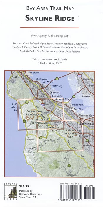
This map covers in detail the many regional parks in the hills above Woodside, Palo Alto, Portola Valley, Los Altos, and Cupertino. Besides full coverage of hiking trails, nearly all local roads are shown so that hikers can find their way to all available trailheads. For example, the map shows back entrances to Rancho San Antonio County Park that aren’t shown on the official map. It also shows how the trails of neighboring parks connect to each other, making it much easier to plan longer hikes.
All official hiking trails were drawn from newly-acquired GPS data with a resolution of about 250 feet. Trail mileages are marked and most streets are labeled. To help hikers keep track of your location, the map shows the locations of memorial grove markers, footbridges, panoramic viewpoints, and stairs. Unofficial trails and dirt roads are shown and greyed out to distinguish them from official hiking trails. We don’t recommend that you use these trails, but if you accidentally wander onto one, having it on the map will help you get back on track. Areas of old-growth redwoods are shaded in dark green, and a UTM grid is provided to help with GPS navigation.
This map replaces Redwood Hikes’ Bay Area Trail Map: Half Moon Bay to Cupertino. This new edition includes numerous updates such as the new Quarry Trail in Rancho San Antonio Open Space Preserve, the new Cowell Purisima Ranch Trail south of Half Moon Bay, and the new staging area in El Corte de Madera Creek Open Space Preserve.
Bored Feet is not currently accepting retail orders. We will still be filling wholesale orders for the foreseeable future. We apologize for any inconvenience.
